
SILVER LAKE
Lake Data
A closer look at the size, depth, geography, and underwater contours of Silver Lake.
Silver Lake at a Glance
From its deep central basin to the streams and watershed that feed it, these characteristics help define Silver Lake and the landscape around it.
995 acres
Lake Area
164 ft
Maximum Depth
46.9 ft
Average Depth
6.90 miles
Shoreline
466 ft
Elevation Above Sea Level
22 sq. miles
Watershed Area
2.86 miles long · Up to 1 mile wide · Four islands · Three inlets · Outlet flows south into the West Branch River
Islands: Big, Bimba, Loon & Half Moon · Inlets: Deer River, Cooks Brook & Forrest Creek
GEOGRAPHY
Silver Lake & Its Surroundings
This New Hampshire Fish and Game reference map combines lake-depth contours with the surrounding landscape, including roads, streams, wetlands, terrain, and conservation or public land.

NH Fish and Game reference map. Not intended for boat navigation.
BATHYMETRY
Beneath the Surface
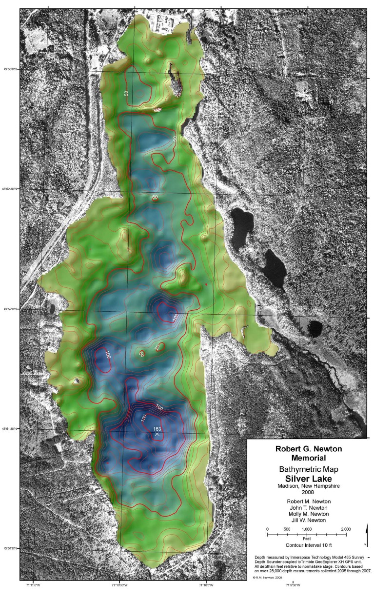
The Robert G. Newton Memorial Bathymetric Map provides a detailed look at the shape of the lake bottom. Its 10-foot contour intervals reveal Silver Lake’s deep basins, slopes, and underwater structure in considerably greater detail.
The map was created from more than 28,000 depth measurements collected between 2005 and 2007 using survey depth-sounding and GPS equipment.
View Full Bathymetric Map →Explore More Silver Lake Maps
Explore additional bathymetric, watershed, aerial, marker, and GIS resources in SLAM’s complete map collection.
Explore Silver Lake Maps →