
EXPLORE
Lake Maps
Explore Silver Lake through marker, bathymetric, watershed, and monitoring maps.
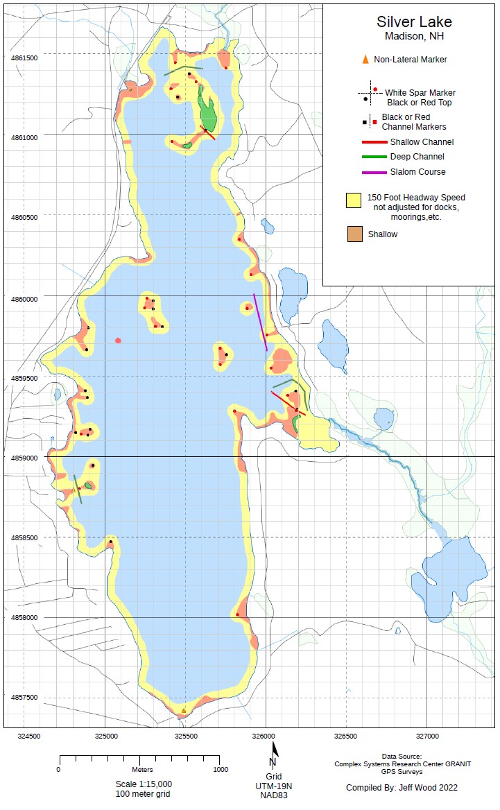
Silver Lake Marker Map
This map identifies the navigational markers and channels placed around Silver Lake, helping boaters and paddlers find their way and steer clear of shallow or restricted areas.
View Full Marker Map →BENEATH THE SURFACE
Bathymetric Maps
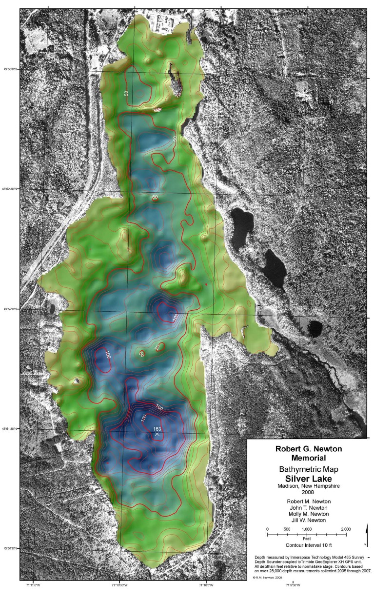
Robert G. Newton Memorial Bathymetric Map — Silver Lake
This map shows the underwater contours and depths of Silver Lake, mapped in 10-foot intervals from more than 28,000 depth measurements.
View Full Silver Lake Bathymetric Map →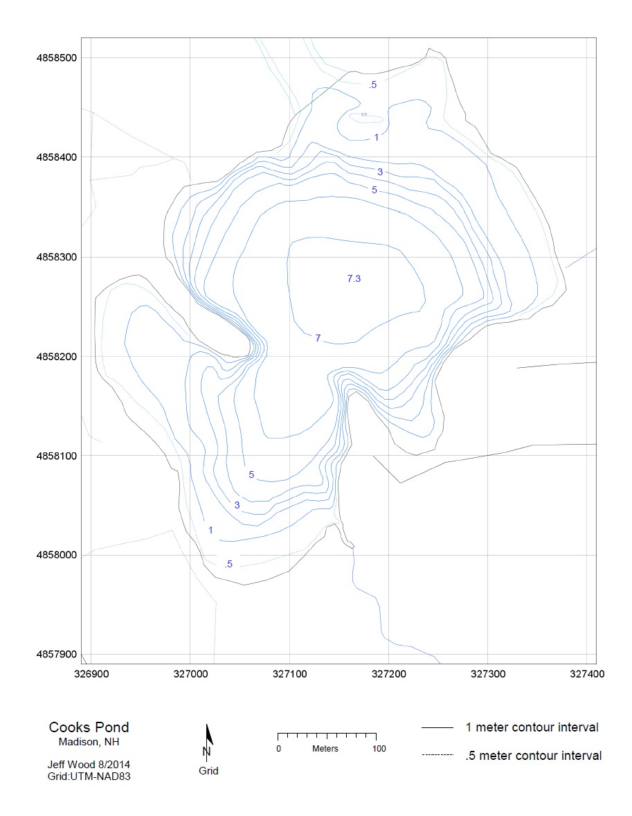
2014 Cooks Pond Bathymetric Map
This companion map shows the underwater contours and depths of Cooks Pond, part of the Silver Lake watershed.
View Full Cooks Pond Bathymetric Map →THE WATERSHED
Silver Lake Watershed Maps
Together, these three views of the Silver Lake watershed show the same area from different angles: elevation and terrain, a LiDAR surface scan, and a 3D rendering of the surrounding landscape.
Topographic View
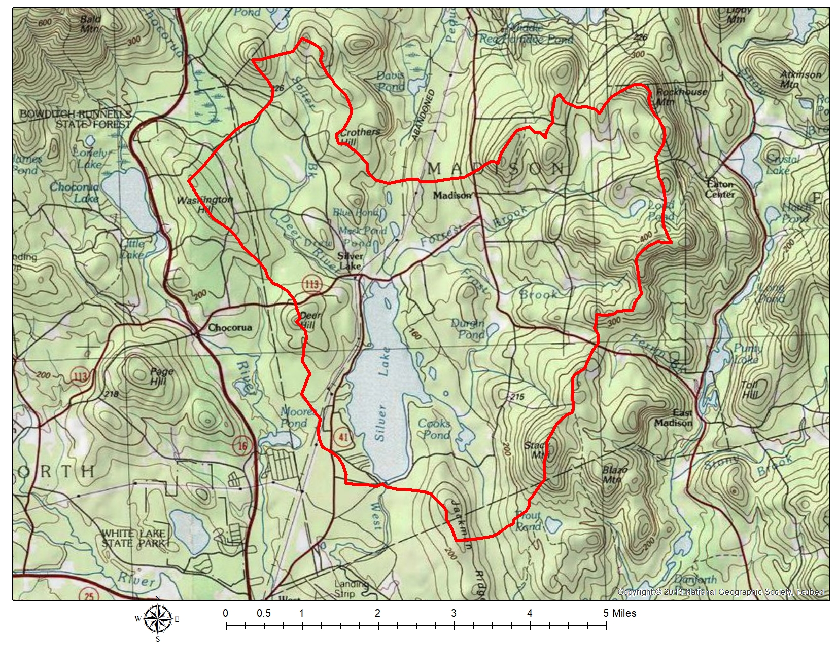
Elevation contours and terrain features across the Silver Lake watershed.
LiDAR View
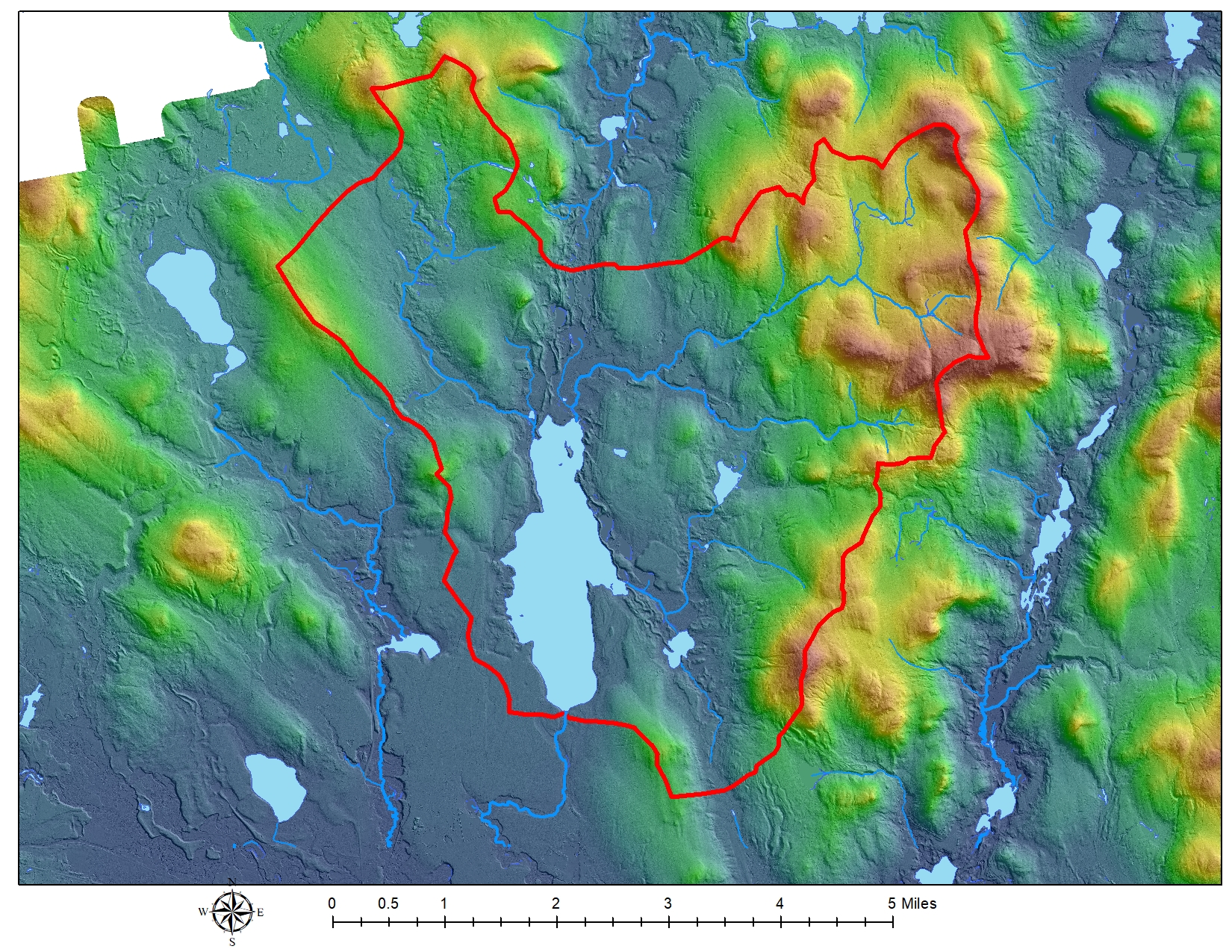
A LiDAR-derived scan of the watershed surface, capturing fine detail in terrain and vegetation.
3D Terrain View

A three-dimensional rendering of the watershed’s terrain and surrounding landscape.
LAKE PROTECTION
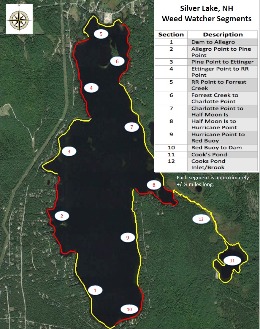
Weed Watching Map
This map divides Silver Lake into the numbered segments used by SLAM’s Weed Watching volunteer program, which monitors aquatic plants and algae and reports any signs of invasive species or cyanobacteria by segment.
Maps & Data Downloads
Download full-resolution maps, GIS data, historical imagery, and related mapping resources.
The GIS dataset (SilverLakeBathymetry10m.zip) requires a GIS program to open. Download and install QGIS, a free open-source option, then use it to view the file.