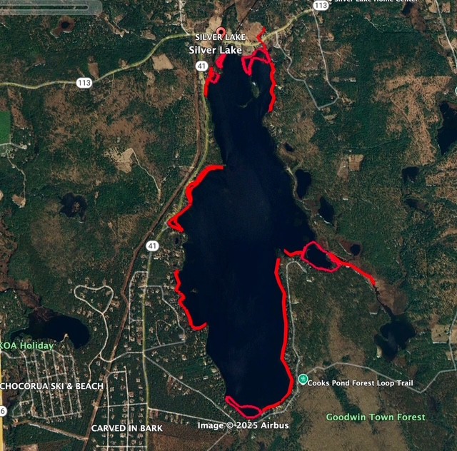
On September 12, Cliff Cabral of New England Milfoil spent approximately 9.5 hours performing a surface survey of Silver Lake under ideal conditions — low wind, flat water, and a sunny day with perfect visibility. Here are the final results from the survey, this time with a map that shows the “hot spots” that our weed watchers should be paying closer attention to:
Referencing the below map: We estimate that approximately half of the Silver Lake shoreline is rocky/sandy, making it difficult for plants to establish themselves; while the other half would be conducive to plant/invasive growth (indicated in red on the map). All of the underwater islands consist of rock piles and thrushes, and no other plant life.
We are happy to report that we found no evidence of invasive plants!